Detailed Satellite
Compass Information
The FI70 can be used to set detailed parameters for the SCX20 and SC33
Satellite Compass. You can assign essential parameters such as ship's
width, length and height as well as the exact antenna position to allow
the Satellite Compass to operate at peak efficiency. The display can also
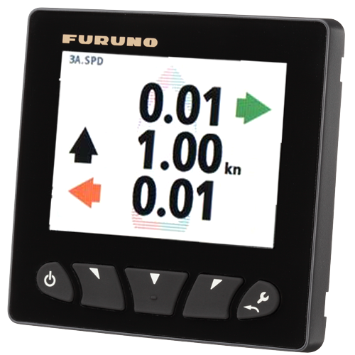
be used as an effective Satellite Compass Indicator, capable of displaying
3-Axis Speed (forward-aft, transverse port-starboard at the bow, and
transverse port-starboard astern). This information can be displayed in
either graphical or digital numeric format, and is useful in evaluating
detailed motion at berth or to see how the vessel has drifted.
Heave, representing the upward and downward motion of the vessel, can also
be displayed. This display offers an up or down arrow indicating direction
of heave, along with a numeric value to indicate distance.
The FI70 can even be used to to display the status of GPS satellites that
the SCX20 and SC33 rely on to operate.




 WARNING:
This product can expose you to chemicals including Di-n-hexyl Phthalate (DnHP)
which is known to the State of California to cause reproductive harm, and
Vinyl Chloride which is known to the State of California to cause cancer. For
more information go to
WARNING:
This product can expose you to chemicals including Di-n-hexyl Phthalate (DnHP)
which is known to the State of California to cause reproductive harm, and
Vinyl Chloride which is known to the State of California to cause cancer. For
more information go to