|
|


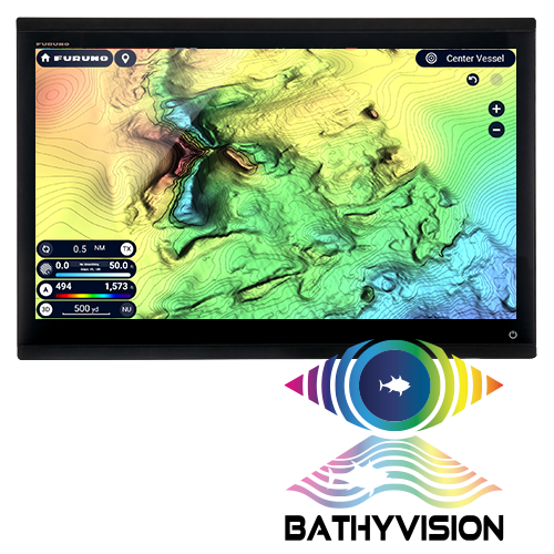
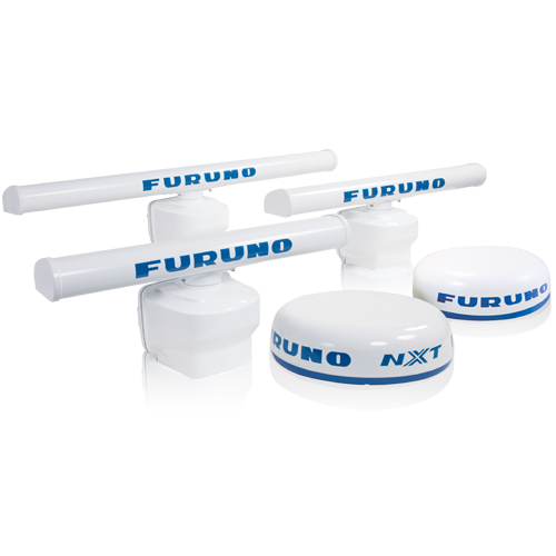
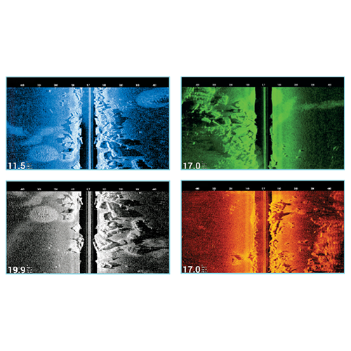
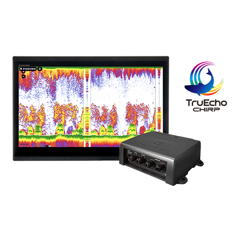
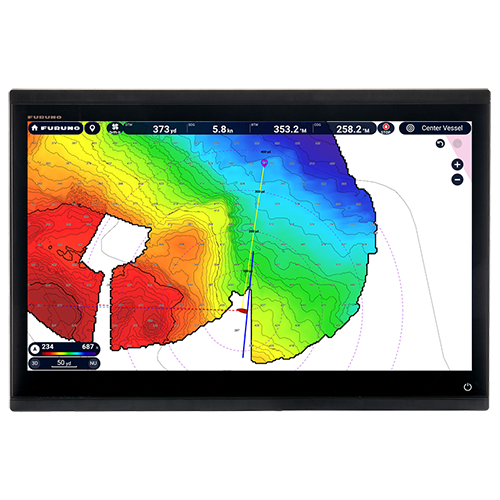
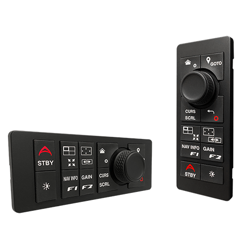
Compatible Accessories Furuno B265LH Bronze Thru-Hull CHIRP Transducer - 12-Pin, B265LH-12P  Furuno B275LHW Bronze Thru-Hull CHIRP Transducer - 12-Pin, B275LHW-12P  Furuno 165T/275LHW-12P Pocket Mount Combo Transducer for DFF3D & TZT3 Displays  Furuno CM275LH-W-12P Urethane Pocket Mount Transducer - 12-Pin  Furuno PM265LH-12P Bronze Pocket Mount CHIRP Transducer - 12-Pin  Furuno PM275LHW-12P Bronze Pocket Mount CHIRP Transducer - 12-Pin  Furuno TM275LHW-12P Transom Mount Transducer - Wide Beam CHIRP - 1kW  Airmar B175C-0-H Broadband CHIRP, Depth & Temperature Thru-Hull 0 Deg Tilted  Airmar B175C-0-HW Wide Broadband CHIRP, Depth & Temperature Thru-Hull 0 Deg Tilted  Airmar B175C-0-L Broadband CHIRP, Depth & Temperature Thru-Hull 0 Deg Tilted  Airmar B175C-0-M Broadband CHIRP, Depth & Temperature Thru-Hull 0 Deg Tilted  Airmar B175C-12-H Broadband CHIRP, Depth & Temperature Thru-Hull 12 Deg Tilted  Airmar B175C-12-HW Wide Broadband CHIRP, Depth & Temperature Thru-Hull 12 Deg Tilted  Airmar B175C-12-L Broadband CHIRP, Depth & Temperature Thru-Hull 12 Deg Tilted  Airmar B175C-12-M Broadband CHIRP, Depth & Temperature Thru-Hull 12 Deg Tilted  Airmar B175C-20-H Broadband CHIRP, Depth & Temperature Thru-Hull 20 Deg Tilted  Airmar B175C-20-HW Wide Broadband CHIRP, Depth & Temperature Thru-Hull 20 Deg Tilted  Airmar B175C-20-L Broadband CHIRP, Depth & Temperature Thru-Hull 20 Deg Tilted  Airmar B175C-20-M Broadband CHIRP, Depth & Temperature Thru-Hull 20 Deg Tilted  Airmar B285C-HW Single Band CHIRP Transducer  Airmar B285C-M Single Band CHIRP Transducer, No Connector  Furuno TM150M Medium CHIRP Transom Mount Transducer  Furuno TM185M Medium-Frequency CHIRP Transducer with Temperature & Stainless Bracket 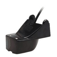 Airmar TM165HW High Wide Chirp Transom Mount Transducer  Furuno TM185HW High Wide CHIRP Transducer with Temp Transom Mount  Furuno TM260 Transom Mount, 50/200 KHz, 1Kw Transducer with Temperature  Furuno CA50/200-1T 1Kw Rubber Transducer  Furuno CA50/200-12M, 50/200 KHz Bronze Thru Hull High Performance Transducer For 1Kw Units  Furuno 520-5MSD 50/200 KHz Bronze Thru Hull Transducer  Furuno 520-5PSD, 50/200 KHz Nylon Thru Hull Depth Transducer  Furuno 525-5PWD, 50/200 KHz Transom Mount Depth Only Transducer 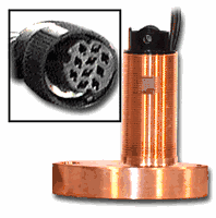 Furuno 525ST-MSD 600W Bronze Multi Transducer 50/200Khz with Fairing Block  Furuno 525STID-PWD, 50/200 KHz, Transom Mount Multi Transducer  Furuno 526T-HDD 50/200 KHz High Performance Bronze 1kw Transducer with Temp & High Speed Fairing Block  Furuno SS60 Stainless Steel Thru Hull Low Profile Transducer with 0 Deg Tilt  Furuno SS60 Stainless Steel Thru Hull Low Profile Transducer with 12 Deg Tilt  Furuno SS60 Stainless Steel Thru Hull Low Profile Transducer with 20 Deg Tilt  Furuno ST-02MSB Bronze Speed/Temp Transducer  Furuno ST-02PSB Transducer with Speed/Temp  Furuno ST-01PTB Transducer Speed/Temp  Furuno 50/200 KHz Transducer In Hull 520-IHD  Furuno 520-BLD Bronze Thru-Hull, Low Profile, Transducer, 600w (10-Pin)  Furuno 520-PLD, 50/200 KHz Nylon LP Depth For 6100-600L-582L-16&1850Df  Furuno B117 Bronze Thru-Hull with Depth & Temp 520T-BLD  Furuno B60-12, 50/200 KHz 12 Deg Tilted Element Transducer with 10P Pigtail Connector 525T-LTD/12  Furuno B60-20, 50/200 KHz 20 Deg Transducer with 10P Pigtail Connector 525T-LTD/20  Furuno 525T-PWD Transom Mount with Temp 50/200Khz (10Pin)  Furuno 1Kw, 50/200 KHz Bronze Thru Hull with Temp & High Speed Fairing Block 525TID-BHD  Furuno 525TID-TMD (TM258), 50/200 KHz Transom Mount 1Kw Units  Furuno 50/200Khz 1Kw In-Hull Transducer 10 Pin 527ID-IHD  Furuno 556TID-HDD, 50/200 KHz 1Kw Stainless Steel with Temp & with Fairing Block  Furuno Stainless Steel 50/200Khz 12 Deg Tilt Thru Hull Transducer 555-SLTD/12  Furuno Stainless Steel 50/200Khz 20 Deg Tilt Thru Hull Transducer 555-SLTD/20  Airmar M265C-LH Broadband CHIRP, Depth Only In-Hull Transducer  Furuno Side Scan Transom Mount for TZT3, 225T-TM904  Furuno Thru-Hull Side-Scan Transducer 12-Pin for TZtouch3 12, 16 & 19 Models, 225T-SS904  Furuno Side Scan Paired Thru-Hull Transducers for TZT3, 225T-PR904 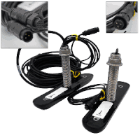 Furuno 455T-PR903 Side-Scan Thru-Hull Transducer Pair  Furuno 455T-SS903 Side-Scan Stainless Steel Thru-Hull Transducer  Furuno 455T-TM903 Side-Scan Transom Mount Transducer  Furuno MCU006 Remote Keyboard For TZTouch3, TZTouchXL, and TZT2BB  Furuno MCU006H Remote Keyboard For TZTouch3, TZTouchXL, and TZT2BB  Furuno MCU005 Keyboard for TZTouch2 & TZT2BB 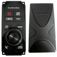 Furuno MCU004 Remote Control for NavNet TZtouch/TZtouch2  Furuno DFF1-UHD TruEcho CHIRP Sounder Module  Furuno DFF3D Sonar Box for TZTouch or TZTouch2  Furuno DFF3-UHD TruEcho CHIRP Black Box Fishfinder 2kW-3kW for NavNet TZouch3 & TZtouch2 TZT2BB  Furuno DI-FFAMP Deep Impact TruEcho CHIRP Fish Finder Amplifier - 2kW or 3kW  Furuno FA40 AIS Receiver 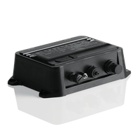 Furuno FA70 AIS Transceiver  Furuno InfoLINK BBWX4 Satellite Weather Receiver  Furuno 220WX Ultrasonic Weather Station  Furuno PG700 Rate Compass Heading Sensor  Furuno RD33 4.3" Color LCD Navigational Data Organizer  Furuno FI70 4.1" Color LCD Instrument/Data Organizer  Furuno SCX20 Compact Dome Satellite Compass (1.0 Heading Accuracy), NMEA2000 Certified  Furuno SC33 Satellite Compass, NMEA2000 (0.4 degree Heading Accuracy) with 6M Cable  Furuno Fi5001 Wind Transducer Requires Cable  Furuno Fi5002 NMEA2000 Junction Box  Furuno Smart Sensor For Fi50 Thru Hull Transducer For Depth/Temperature Dt-800Psf  Furuno Smart Sensor For Fi50 Transducer For Depth/Speed/Temperature DST-800Pwf  Furuno Plastic In-Hull, 235Khz Digital Depth Sensor, NMEA2000 235-IHF  Furuno 235-MSLF Bronze thru-Hull 235Khz, Long-Stem, Digital Depth & Temp Sensor, NMEA2000  Furuno DST-810MSF Bronze Thru-Hull, Digital Depth, Speed, Temp Sensor, NMEA2000  Furuno DT-800MSF Bronze Thru-Hull, Digital Depth & Temp Sensor, NMEA2000 Furuno DST-810MSF Bronze Thru-Hull, Digital Depth, Speed, Temp Sensor, NMEA2000 Furuno DRS12ANXT/3 100 Watt Solid-State Doppler Radar 96nm with 3.5' antenna & 15m cable Furuno DRS12ANXT/4 100 Watt Solid-State Doppler Radar 96nm with 4' antenna & 15m cable Furuno DRS12ANXT/6 100 Watt Solid-State Doppler Radar 96nm with 6' antenna & 15m cable  Furuno DRS12AX/3 12kw X-band Radar Antenna 96nm with 3.5' Open Array & 15m cable  Furuno DRS12AX/4 12kw X-band Radar Antenna 96nm with 4' Open Array & 15m cable  Furuno DRS12AX/6 12kw X-band Radar Antenna 96nm with 6' Open Array & 15m cable Furuno DRS25ANXT/3 Solid State Radar 96nm with 3' Array - 15M Cable Furuno DRS25ANXT/4 Solid State Radar 96nm with 4' Array - 15M Cable Furuno DRS25ANXT/6 Solid State Radar 96nm with 6' Array - 15M Cable  Furuno DRS25AX/3 96nm 25kw X-band Radar with 3.5' Open Array & 15m cable  Furuno DRS25AX/4 96nm 25kw X-band Radar with 4' Open Array & 15m cable  Furuno DRS25AX/6 96nm 25kw X-band Radar with 6' Open Array & 15m cable Furuno DRS2DNXT 19" Solid-State Doppler Radar 48nm with Target Analyzer & Fast Target Tracking (No cable included)  Furuno DRS4D-NXT Solid-State Doppler Radar  Furuno DRS6ANXT/3 25w 72nm Solid-State Radar Antenna with 3.5' Open Array & 10m cable  Furuno DRS6ANXT/4 25w 72nm Solid-State Radar Antenna with 4' Open Array & 10m cable  Furuno DRS6ANXT/6 25w 72nm Solid-State Radar Antenna with 6' Open Array & 10m cable  Furuno DRS6AX/3 6kw 96nm X-band Radar Antenna with 3.5' Open Array & 15m cable  Furuno DRS6AX/4 6kw 96nm X-band Radar Antenna with 4' Open Array & 15m cable  Furuno DRS6AX/6 6kw 96nm X-band Radar Antenna with 6' Open Array & 15m cable |
Our Company Policy | Privacy Policy | Shopping Cart
Copy Right: WMJ Marine Corporation 2004-2026 |