|
|


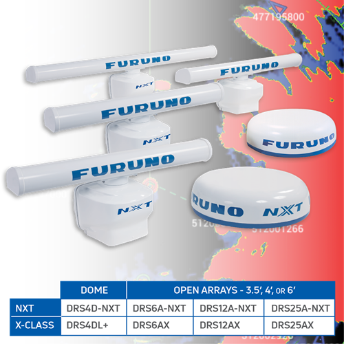
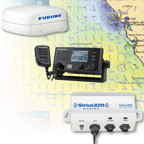
Compatible Accessories Furuno B265LH Bronze Thru-Hull CHIRP Transducer - 12-Pin, B265LH-12P  Furuno B275LHW Bronze Thru-Hull CHIRP Transducer - 12-Pin, B275LHW-12P  Furuno 165T/275LHW-12P Pocket Mount Combo Transducer for DFF3D & TZT3 Displays  Furuno CM275LH-W-12P Urethane Pocket Mount Transducer - 12-Pin  Furuno PM265LH-12P Bronze Pocket Mount CHIRP Transducer - 12-Pin  Furuno PM275LHW-12P Bronze Pocket Mount CHIRP Transducer - 12-Pin  Furuno TM275LHW-12P Transom Mount Transducer - Wide Beam CHIRP - 1kW  Furuno GP330B GPS/WAAS Sensor for NMEA2000  Furuno MM3 Chart For Furuno Navnet 3D  Furuno NavNet TZtouch Remote Control Unit, MCU002 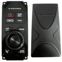 Furuno MCU004 Remote Control for NavNet TZtouch/TZtouch2  Airmar B175C-0-H Broadband CHIRP, Depth & Temperature Thru-Hull 0 Deg Tilted  Airmar B175C-0-HW Wide Broadband CHIRP, Depth & Temperature Thru-Hull 0 Deg Tilted  Airmar B175C-0-L Broadband CHIRP, Depth & Temperature Thru-Hull 0 Deg Tilted  Airmar B175C-0-M Broadband CHIRP, Depth & Temperature Thru-Hull 0 Deg Tilted  Airmar B175C-12-H Broadband CHIRP, Depth & Temperature Thru-Hull 12 Deg Tilted  Airmar B175C-12-HW Wide Broadband CHIRP, Depth & Temperature Thru-Hull 12 Deg Tilted  Airmar B175C-12-L Broadband CHIRP, Depth & Temperature Thru-Hull 12 Deg Tilted  Airmar B175C-12-M Broadband CHIRP, Depth & Temperature Thru-Hull 12 Deg Tilted  Airmar B175C-20-H Broadband CHIRP, Depth & Temperature Thru-Hull 20 Deg Tilted  Airmar B175C-20-HW Wide Broadband CHIRP, Depth & Temperature Thru-Hull 20 Deg Tilted  Airmar B175C-20-L Broadband CHIRP, Depth & Temperature Thru-Hull 20 Deg Tilted  Airmar B175C-20-M Broadband CHIRP, Depth & Temperature Thru-Hull 20 Deg Tilted  Airmar B285C-HW Single Band CHIRP Transducer  Airmar B285C-M Single Band CHIRP Transducer, No Connector  Furuno TM150M Medium CHIRP Transom Mount Transducer  Furuno TM185M Medium-Frequency CHIRP Transducer with Temperature & Stainless Bracket 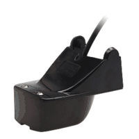 Airmar TM165HW High Wide Chirp Transom Mount Transducer  Furuno TM185HW High Wide CHIRP Transducer with Temp Transom Mount  Furuno TM260 Transom Mount, 50/200 KHz, 1Kw Transducer with Temperature  Furuno CA50/200-1T 1Kw Rubber Transducer  Furuno CA50/200-12M, 50/200 KHz Bronze Thru Hull High Performance Transducer For 1Kw Units  Furuno 520-5MSD 50/200 KHz Bronze Thru Hull Transducer  Furuno 520-5PSD, 50/200 KHz Nylon Thru Hull Depth Transducer  Furuno 525-5PWD, 50/200 KHz Transom Mount Depth Only Transducer 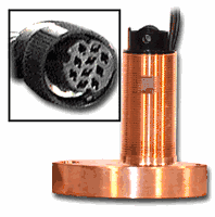 Furuno 525ST-MSD 600W Bronze Multi Transducer 50/200Khz with Fairing Block  Furuno 525STID-PWD, 50/200 KHz, Transom Mount Multi Transducer  Furuno 526T-HDD 50/200 KHz High Performance Bronze 1kw Transducer with Temp & High Speed Fairing Block  Furuno SS60 Stainless Steel Thru Hull Low Profile Transducer with 0 Deg Tilt  Furuno SS60 Stainless Steel Thru Hull Low Profile Transducer with 12 Deg Tilt  Furuno SS60 Stainless Steel Thru Hull Low Profile Transducer with 20 Deg Tilt  Furuno ST-02MSB Bronze Speed/Temp Transducer  Furuno ST-02PSB Transducer with Speed/Temp  Furuno ST-01PTB Transducer Speed/Temp  Furuno 50/200 KHz Transducer In Hull 520-IHD  Furuno 520-BLD Bronze Thru-Hull, Low Profile, Transducer, 600w (10-Pin)  Furuno 520-PLD, 50/200 KHz Nylon LP Depth For 6100-600L-582L-16&1850Df  Furuno B117 Bronze Thru-Hull with Depth & Temp 520T-BLD  Furuno B60-12, 50/200 KHz 12 Deg Tilted Element Transducer with 10P Pigtail Connector 525T-LTD/12  Furuno B60-20, 50/200 KHz 20 Deg Transducer with 10P Pigtail Connector 525T-LTD/20  Furuno 525T-PWD Transom Mount with Temp 50/200Khz (10Pin)  Furuno 1Kw, 50/200 KHz Bronze Thru Hull with Temp & High Speed Fairing Block 525TID-BHD  Furuno 525TID-TMD (TM258), 50/200 KHz Transom Mount 1Kw Units  Furuno 50/200Khz 1Kw In-Hull Transducer 10 Pin 527ID-IHD  Furuno 556TID-HDD, 50/200 KHz 1Kw Stainless Steel with Temp & with Fairing Block  Furuno Stainless Steel 50/200Khz 12 Deg Tilt Thru Hull Transducer 555-SLTD/12  Furuno Stainless Steel 50/200Khz 20 Deg Tilt Thru Hull Transducer 555-SLTD/20  Airmar M265C-LH Broadband CHIRP, Depth Only In-Hull Transducer  Furuno DRS4DL+ Radar Dome, 4kw, 19" 36NM (No cable included)  Furuno DRS4D-NXT Solid-State Doppler Radar  Furuno DRS6AX/3 6kw 96nm X-band Radar Antenna with 3.5' Open Array & 15m cable  Furuno DRS6AX/4 6kw 96nm X-band Radar Antenna with 4' Open Array & 15m cable  Furuno DRS6AX/6 6kw 96nm X-band Radar Antenna with 6' Open Array & 15m cable  Furuno DRS12AX/3 12kw X-band Radar Antenna 96nm with 3.5' Open Array & 15m cable  Furuno DRS12AX/4 12kw X-band Radar Antenna 96nm with 4' Open Array & 15m cable  Furuno DRS12AX/6 12kw X-band Radar Antenna 96nm with 6' Open Array & 15m cable  Furuno DRS25AX/3 96nm 25kw X-band Radar with 3.5' Open Array & 15m cable  Furuno DRS25AX/4 96nm 25kw X-band Radar with 4' Open Array & 15m cable  Furuno DRS25AX/6 96nm 25kw X-band Radar with 6' Open Array & 15m cable  Furuno DRS6ANXT/3 25w 72nm Solid-State Radar Antenna with 3.5' Open Array & 10m cable  Furuno DRS6ANXT/4 25w 72nm Solid-State Radar Antenna with 4' Open Array & 10m cable  Furuno DRS6ANXT/6 25w 72nm Solid-State Radar Antenna with 6' Open Array & 10m cable Furuno DRS12ANXT/3 100 Watt Solid-State Doppler Radar 96nm with 3.5' antenna & 15m cable Furuno DRS12ANXT/4 100 Watt Solid-State Doppler Radar 96nm with 4' antenna & 15m cable Furuno DRS12ANXT/6 100 Watt Solid-State Doppler Radar 96nm with 6' antenna & 15m cable Furuno DRS25ANXT/3 Solid State Radar 96nm with 3' Array - 15M Cable Furuno DRS25ANXT/4 Solid State Radar 96nm with 4' Array - 15M Cable Furuno DRS25ANXT/6 Solid State Radar 96nm with 6' Array - 15M Cable  Furuno DI-FFAMP Deep Impact TruEcho CHIRP Fish Finder Amplifier - 2kW or 3kW |
Our Company Policy | Privacy Policy | Shopping Cart
Copy Right: WMJ Marine Corporation 2004-2025 |